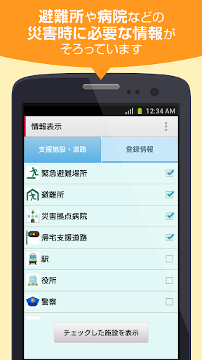
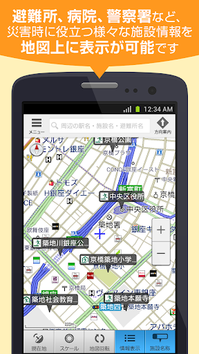
1. **Disaster Preparedness Mapping:** The app provides detailed maps of evacuation shelters, allowing users to plan escape routes and locate safe areas during emergencies ahead of time.
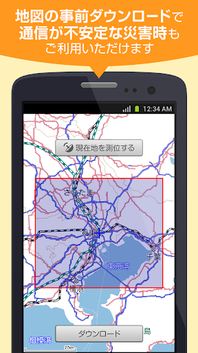
2. **No Communication Required:** It functions without the need for an internet connection, ensuring accessibility even when networks are down during a disaster.
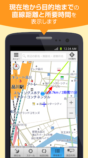
3. **Assisted Homeward Navigation:** The app offers support for individuals trying to return home, by suggesting the safest and quickest routes amidst the chaos of a disaster scenario.
1. Limited Update Frequency: The app's disaster map information might not be updated in real-time, potentially compromising the accuracy of evacuation center locations during rapidly evolving natural disasters.
2. No Real-time Communication: Lacking the capability for instant messaging or updates, users cannot receive or share immediate updates or distress signals with others during emergencies.
3. Dependence on Preset Data: Relying solely on preloaded data, the app may not provide support for routes or facilities that have changed post-installation, leading to potential confusion or misdirection during critical situations.